Journalism of Courage
Premium
This is an archive article published on December 11, 2008
Mapping the Past
A collection of early Victorian maps is ready to be unveiled at Chatrapati Shivaji Maharaj Vastu Sangrahalaya next week.
Written by Nikhilroshan
December 11, 2008 12:00 AM IST 3 min read


Two exhibitions, and a lecture in the city hope to generate interest in a hitherto forgotten art-form of cartography
A collection of early Victorian maps is ready to be unveiled at Chatrapati Shivaji Maharaj Vastu Sangrahalaya next week. It seems sheer coincidence then that there should be three events in the city that showcase and analyse the art of cartography, all within the same week. “The events are indicative of a growing historic and aesthetic interest among collectors and buyers. So far no one recognised maps as an art-form,” suggests Pheroza Godrej, who is curating the exhibition at the museum, called India Encompassed.
An exhibition and sale of early colonial cartography, lithographs, engravings and etchings from Dilnavaz Mehta’s collection that are being shown at the Cymroza Art Gallery, Breach Candy, form a good precursor to the exhibition at the museum. This exhibition curated by the owner of Rare Finds, a store in Dadar, took off on Tuesday. One sees tinted lithographs, by colonial painters such as James Hunter, Francis Swain Ward and Thamas Daniel, which typically map out Indian landscape and ‘native types’. These, when seen alongside maps of the Indian subcontinent by early colonial cartographers such as Johannes Blau (Dutch), Abraham Chatelain (French) or the British James Rennel give a fair idea of the advancements made by Colonists — both in penetrating into the land and in cartography. Rennel’s 1782 map was the first accurate depiction of the India subcontinent.
“Early maps lack knowledge of the interiors or the hinterlands. The early foreign traders were only concerned with ports. So you see a Surat, Cochin or Diu depicted clearly. But that changes with later colonial cartographers,” says Farooq Issa of Phillip’s Antiques store, Colaba, that will provide 50 maps for the exhibition at the museum. It will be inaugurated on December 15.
With the coming of more advanced cartography—which is less notional and increasingly based on ground surveys—in the mid-18th century, there is a decline in embellishments that made earlier maps as good as works of art. Several early maps that show sea-trade routes also feature illustrations of ships, sea creatures and rough seas. There are also images of Biblical and mythological figures and royal symbols which disappeared in later maps. The colonial surveys also signalled the end of our own indigenous Mogul, Maratha, Kashmiri, Marwari or Nepali map-making traditions. “Though Arab map-making traditions died with the entry of colonists, war and hunting maps made by the Marathas, though notional, were really accurate,” explains Prof Arunachalam, former Head of Mumbai University’s Geography Department, who will be lecturing on early Maratha cartographic traditions on Saturday at the Y B Chavan auditorium.
“India Encompassed was conceived to be seen alongside the collection from Victorian Albert Museum called Indian Life and Landscapes at the Curator Gallery. People in Mumbai need to see the early attempts at cartography,” explains Sabyasachi Mukherjee, director of the museum. And though these maps are being placed period-wise accompanied by small write-ups, what could help is a contextualisation of this work; a deeper look at the nature of colonialism that facilitated the science of cartography and perhaps a study of symbols that evolved or disappeared with advancing cartographic practices.
Advertisement

Live Blog
PHOTOS


Top Stories


Advertisement
Must Read


Advertisement
Buzzing Now
TrendingUS YouTuber Tyler Oliveira triggers backlash after filming cow dung-flinging ritual in Indian village: who is he?

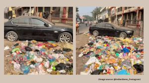
TrendingSerbian man on cleanup mission spots BMW car dumped among trash in Amritsar, video sparks criticism: 'disgrace for luxury cars'

TrendingCockroach found in Air India's Dubai-bound flight 'hanged till death', says flight's cabin defect logbook: 'Khallas'


- 01
- 02
- 03
- 04
- 05
Advertisement